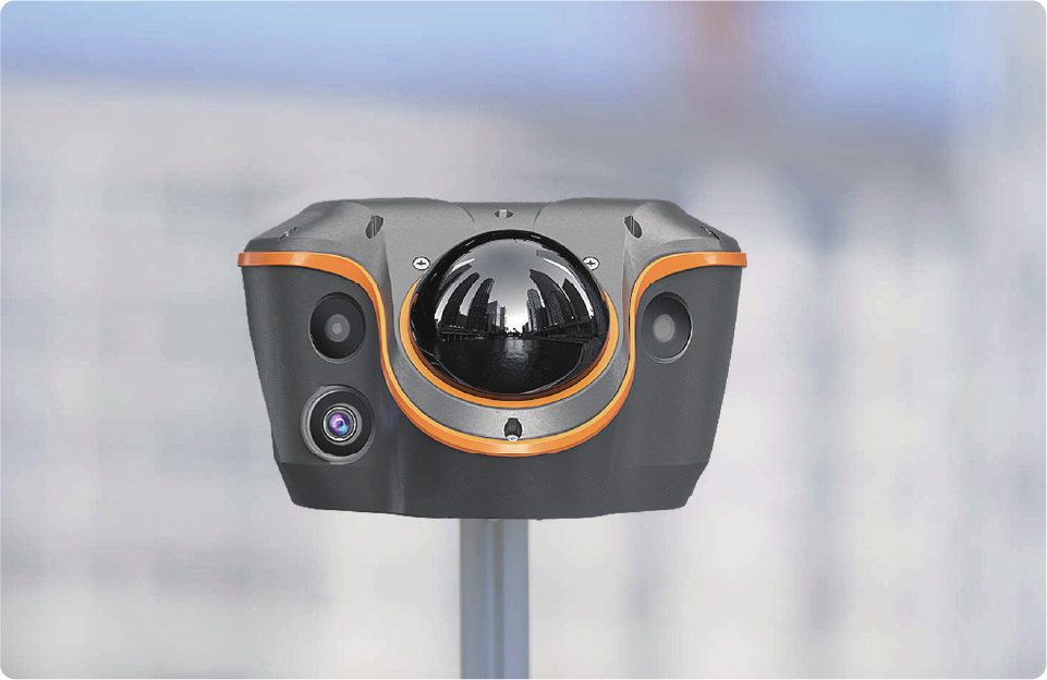
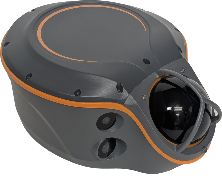
i100 Visual LiDAR (ViLi)
GNSS RTK
|
|
[ Pricing ]
[ Software ] [
Specifications ] [
Case Contents ] [
Videos ] |
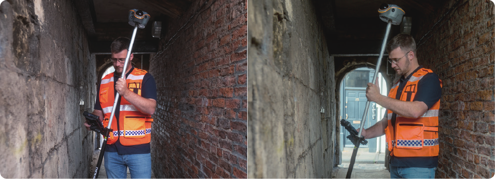
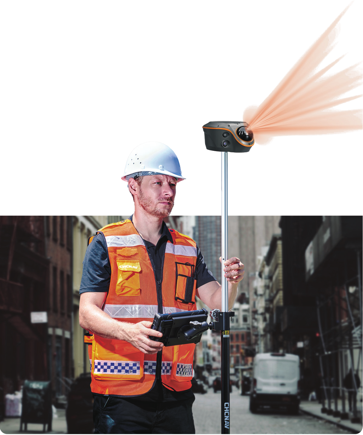
Visual-LiDAR RTK rover. Accuracy in
obstructed and GNSS-denied environments.
[
Datasheet ] [
User Manual ]
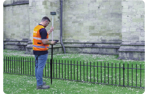
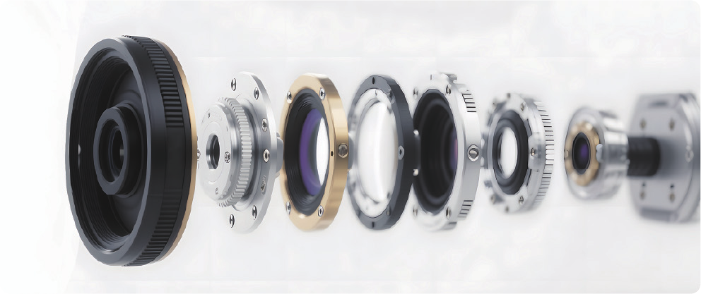
The CHCNAV ViLi i100 is a full-constellation RTK GNSS rover
with integrated 96-line LiDAR scanner, 8 MP telephoto
camera, dual color cameras, and a 200-Hz IMU.
It is
built to hold
accuracy where conventional GNSS receivers fall apart:
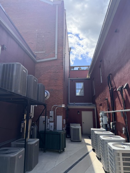
narrow alleys, under viaducts, dense urban canyons, under
eaves, and tight construction corridors. It achieves this by
integrating IMU, Visual SLAM along with GNSS positioning.
SFix 2.0 engine maintains accuracy within a 20 m radius
of initialization in fully GNSS-denied spaces using
LiDAR and SLAM.
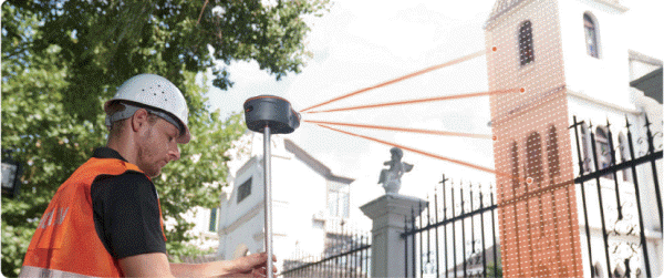
Vi-LiDAR contactless survey: take one photo with the 8
MP telephoto, extract multiple 3D points per shot out to
15 m.
Real-time 3D point cloud earthwork - cut/fill volumes
computed on-site in LandStar with no rod contact
required.
|
 |
|
|
|
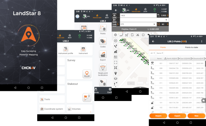
LandStar field software runs
the conventional RTK workflow, the Vi-LiDAR
contactless workflow, the SFix obstructed-area
workflow, the AR visual stakeout workflow, and the
on-site earthwork volume workflow on the same data
collector. One field software, one rover, no total
station to switch to when the sky disappears under
canopy or inside buildings. |
|
SFix 2.0 Engine and the GNSS-Denied
Workflow
|
|
SFix 2.0 earns its keep on the
jobs where RTK failed in the past. The 96-line LiDAR
captures 860,544 points per second across a 360° ×
90° field of view at 30-meter range, and SFix 2.0
uses that data with SLAM-derived angular constraints
to reconstruct the rover position.
Continue to use the receiver in
GPS-denied environments within 20-meters of SFix 2.0
initialization. Beyond 20 meters the error grows
roughly 3 cm per additional 10 meters.
Multipath-affected signals are
filtered automatically by real-time satellite path
analysis, eliminating the false-fix trap in obstructed RTK work.
The receiver does not silently degrade or jump; it
holds a real-fix aided with IMU and SLAM.
SFix supports a seamless
handoff from open-sky RTK into obstructed work, and
tilt compensation extends through the full 0–360°
range in SFix mode (0–60° in conventional RTK).
|
 |
|
Vi-LiDAR Contactless Survey
|
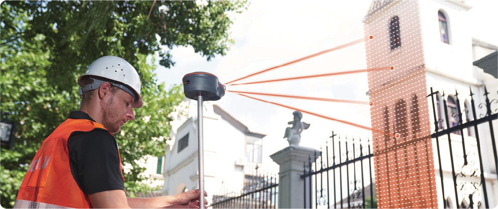 |
The Vi-LiDAR workflow uses the 8 MP F/2.2 telephoto
camera and the LiDAR together to extract multiple 3D
coordinates from a single photo. Aim the receiver at
the corner, the curb, the gas valve, or the fence
line, take one shot, and pick points off the
resulting image - each pixel resolves to a
coordinate in the project CRS. ±5 cm (0.16 feet) typical
accuracy at 15 meters, with an optimal imaging range
of 5 to 20 meters. |
|
|
In practical terms, eliminate pole-on-the-point work
for any feature the operator can see and photograph.
The surveyor stands in a safe location, photographs
the feature, and picks the points.
For batch capture, one shot can produce many points:
corners of a building face, individual tops of a
fence row, all four corners of a manhole, cracks
along a pavement edge. The crew shoots once and
picks many - significantly faster than
rod-on-the-point work for feature-rich captures. |
 |
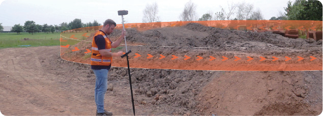
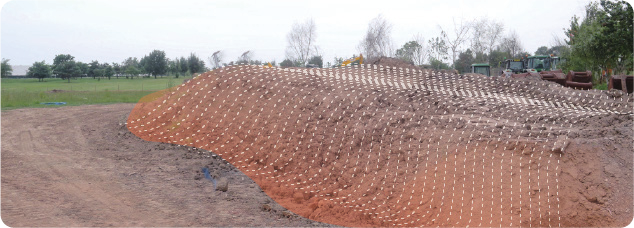
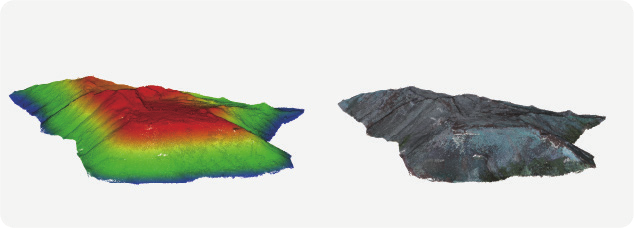
Real-Time 3D Point Cloud Earthwork
|
|
Stockpile and excavation volumes are computed on-site in
LandStar from the live point cloud. Walk the perimeter or
scan from a fixed setup, define the boundary on the data
collector, and the cut/fill volumes are returned.
This is a non-contact volumetric workflow. The operator does
not need to walk the surface, plant rod shots across the
pile, or set up a drone flight - relevant when the material
is hazardous (contaminated soils, unstable scree), when the
surface is unsafe to traverse (active dump faces, soft
fill), or when the schedule does not permit shutting down
equipment on the pile.
|
Camera System and AR Visual Stakeout
|
|
The ViLi i100 carries three cameras with distinct purposes:
a forward-facing 8 MP F/2.2 HD telephoto for Vi-LiDAR
contactless survey, dual forward-facing 2 MP wide-angle
color cameras with 130°(H) × 46°(V) combined FOV for
full-color point cloud colorization, and a 2 MP 90°-FOV
bottom-facing camera that drives AR visual stakeout.
AR Visual
Stakeout
|
Vi-LiDAR captures one photo with 800,000 LiDAR points making it
possible to extract multiple 3D coordinates instantly. One photo,
unlimited targets; no pointing, alignments or steady holds required.
Accurate, non-contact measurements are possible from
a safe distance. |
|
Software: LandStar 8 Field Software
|
|
LandStar runs the full ViLi i100 workflow on Android:
conventional RTK, Vi-LiDAR contactless survey, SFix
obstructed-area positioning, AR visual stakeout, and on-site
earthwork volume calculation in one application. The
operator does not switch apps to switch workflows.
Firms that already run LandStar on CHC
GNSS receivers will find the same workflow and project
structure carry over.
The full Vi-LiDAR, SFix 2.0, AR stakeout, and on-site
earthwork workflows are LandStar-specific - third-party
field software does not drive the visual or LiDAR features.
If your firm's existing workflow is built around a different
field application, evaluate the LandStar workflow before
ordering. You can do a full evaluation using these detailed
[
instructions ]. Call us and we can help you with your
evaluation.
|
Specifications
[
Datasheet ]
[ User Manual ]
GNSS Performance
| Channels |
1892 (iStar2.0) |
| GPS |
L1C/A, L1C, L2C, L2P(Y), L5 |
| GLONASS |
G1, G2, G3 |
| Galileo |
E1, E5a, E5b, E6 |
| BeiDou |
B1I, B2I, B3I, B1C, B2a,
B2b |
| QZSS |
L1C/A, L1C, L2C, L5 |
| NavIC / IRNSS |
L5 |
| SBAS |
L1C/A |
ViLi Accuracies
| SFix survey (with GNSS) |
±3 cm (2σ) |
| SFix survey (no GNSS) |
±5 cm (2σ)
within 20 m radius of initialization point
Tilt compensation 0–360° |
| Vi-LiDAR survey |
Multiple points
per shot, range 5–20 m
Typical ±5 cm @ 15 m with GNSS signal |
LiDAR
| Number of lines |
96 |
| Point frequency |
860,544 pts/sec
(single-echo) |
| Range |
30 m @ 10% reflectivity, 70
m @ 80% reflectivity |
| Field of view |
360°(H) × 90°(V) |
Camera System
| Vi-LiDAR
telephoto |
8 MP HD, F/2.2, FOV
77.5°(H) × 48.8°(V), optimal range 5–20 m |
| Color cameras (dual) |
2 MP each, combined FOV
130°(H) × 46°(V)
Wide-angle coloring, true-color point cloud |
| Bottom AR camera |
2 MP, FOV 90°, AR visual
stakeout |
Communication and Connectivity
| Built-in UHF radio |
410–470 MHz, receive-only
Protocols: CHC, Transparent, TT450 |
| Data storage |
64 GB internal (~1 h scan
or 30 h point cloud), expandable to 1 TB |
| Ports |
1 × USB 3.0 Type-C (data
download), 1 × UHF antenna (SMA male) |
| Data formats |
RTCM 2.x / 3.x, CMR I/O;
HCN, RINEX 2.11/3.02; NMEA 0183; NTRIP client; |
Electrical
| Operating time on internal
battery |
Up to 5 h scanning; typical
22 h RTK rover |
| Quick charge |
Up to 30 W PD fast
charging, full charge in 5 h |
Hardware and Environment
| Size (L × W ×
H) |
208 × 162 × 95.5 mm (8.19 ×
6.38 × 3.76 in) |
| Weight |
1.39 kg (3.06 lb) |
| Ingress protection |
IP67 (IEC 60529) |
| Shock resistance |
IK08 |
|
Notes
RTK Corrections
For georeferenced
scans, the i100 needs a source of RTK corrections or static
base data. This applies to scans that begin and end outdoors
where a GNSS fix is possible.
The i100 does have a receive-only
UHF radio.
It is possible to use CHC or iGage
base stations which include APIS service for FREE!
APIS allows a single Base and one or more Rovers to connect
through the internet cloud with a SIM card in the base. It
is very easy to configure.
If cellular service is not
available, a local base can broadcast UHF corrections to the
i100. The
SG7 and
eBASE
are both good choices for a local base because they support
static and APIS/RTK corrections:

 |
Pricing
Kits include:
- i100 Main Unit
- LT800 Tablet
- Tablet Mount + Bracket
- SMA UHF Antenna
- Charging Cables
i100 Kits
|
i100 Standard
|
|
$
19,900 |
|
What's in the case?
The i100 kit is a complete system
and includes a tablet with licensed field software.
|
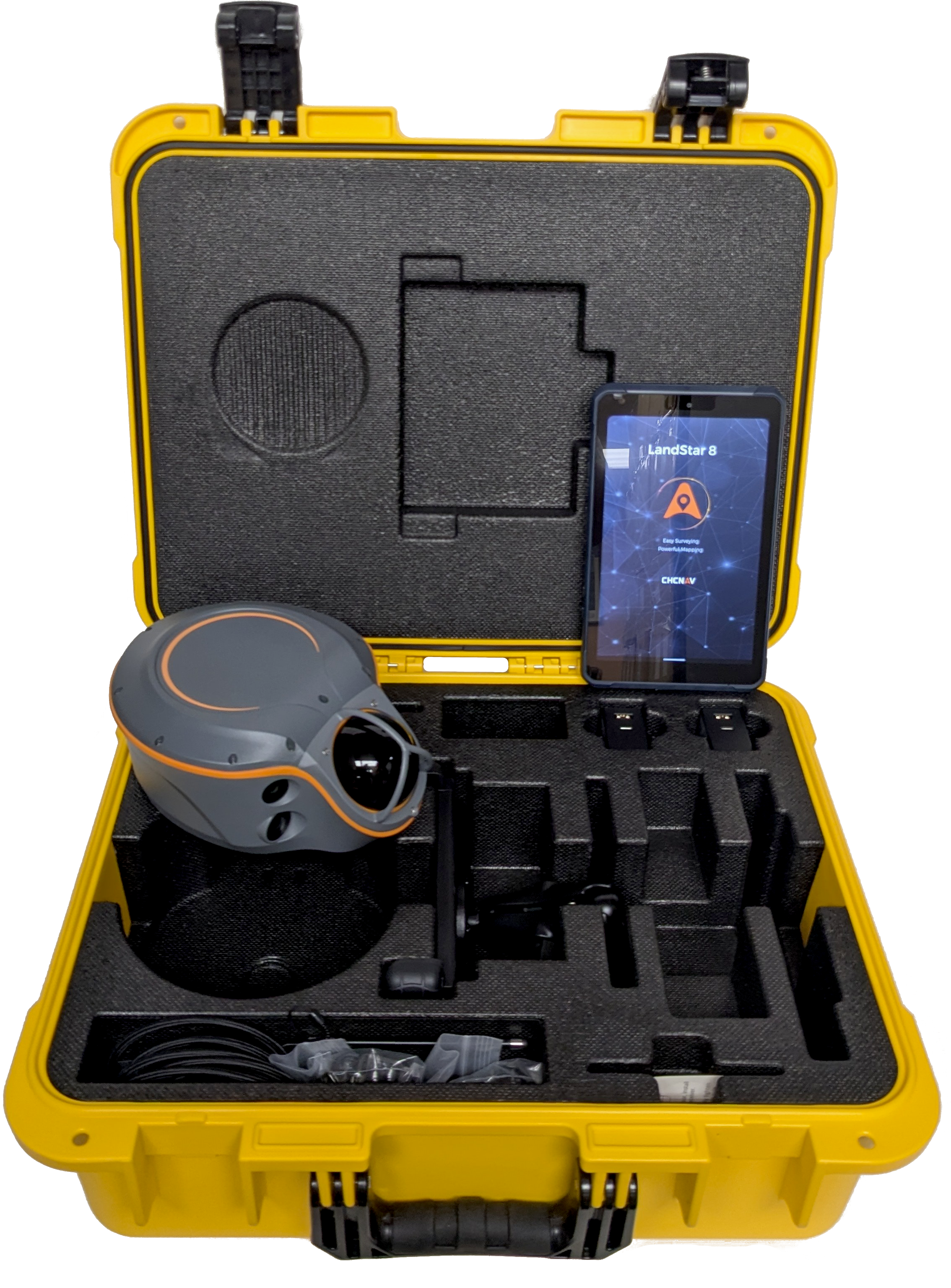
Carry Case Contains |
|
i100 body |
|
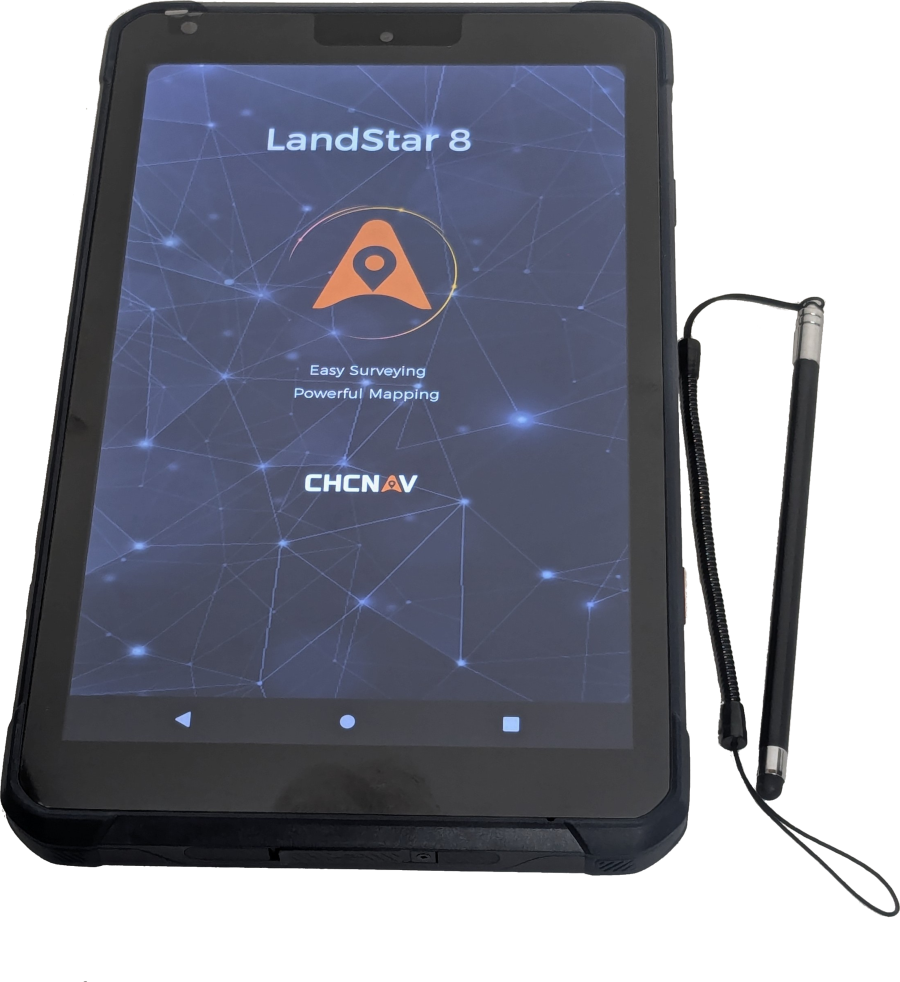
LT800
Collector Tablet |
|
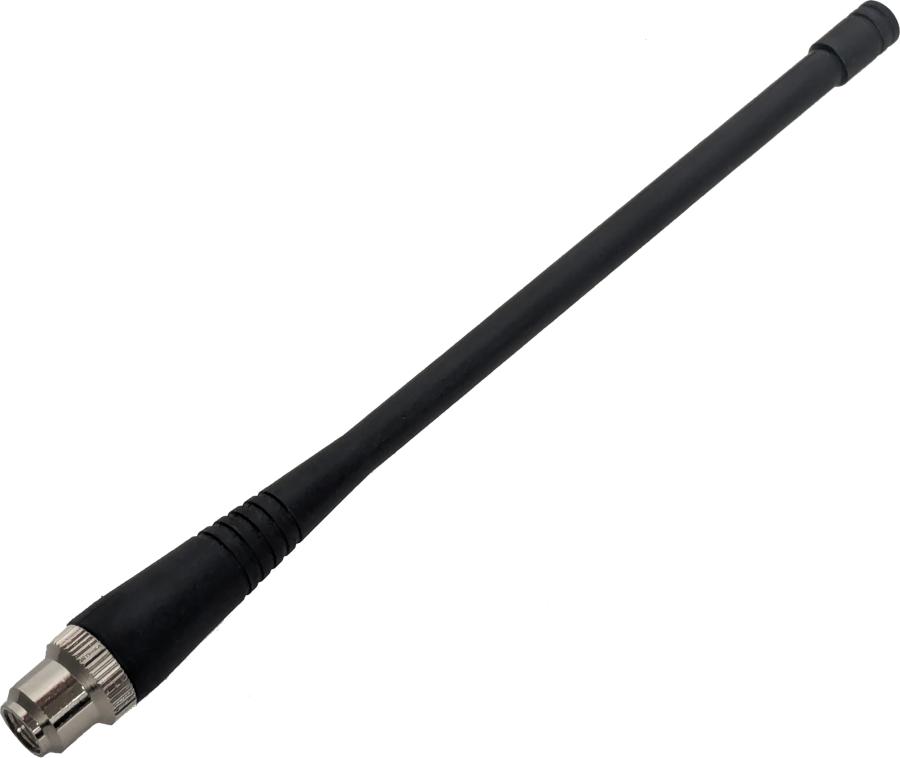
SMA UHF
Antenna |
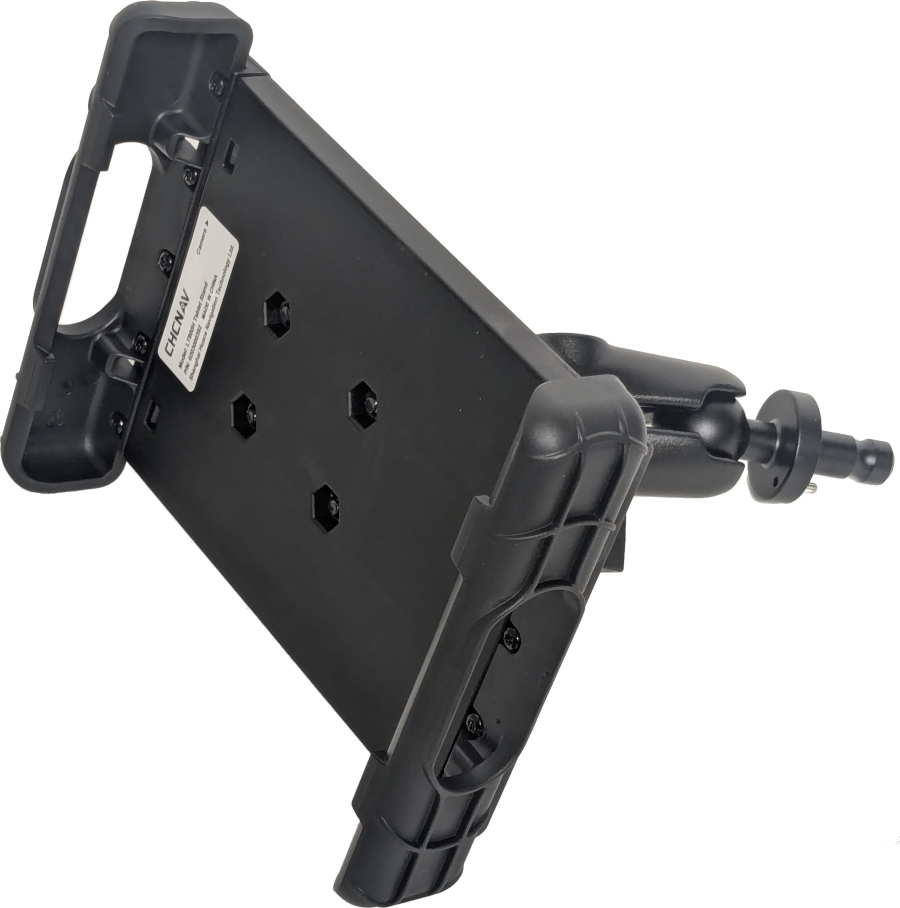
Tablet Mount |
|
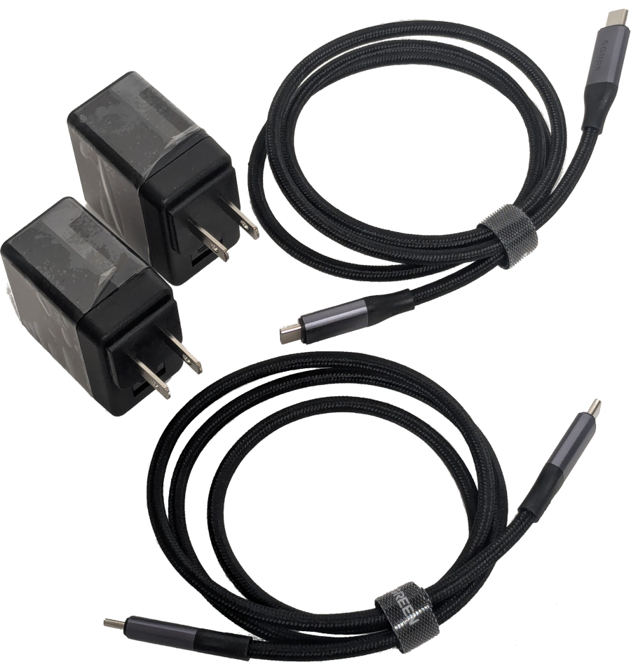
Data and Charging Cables |
|
Videos
YouTube videos from the manufacturer:
|
|