|
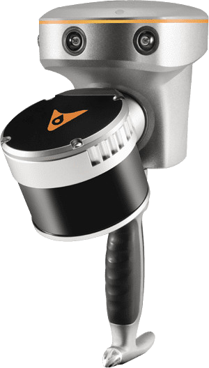
RS7 Handheld LiDAR SLAM Scanner
|
| [
Pricing ] [ Software
] [ Sample Data ] [
Specifications ] [
Notes ] [ Case
Contents ] [ Videos ] |
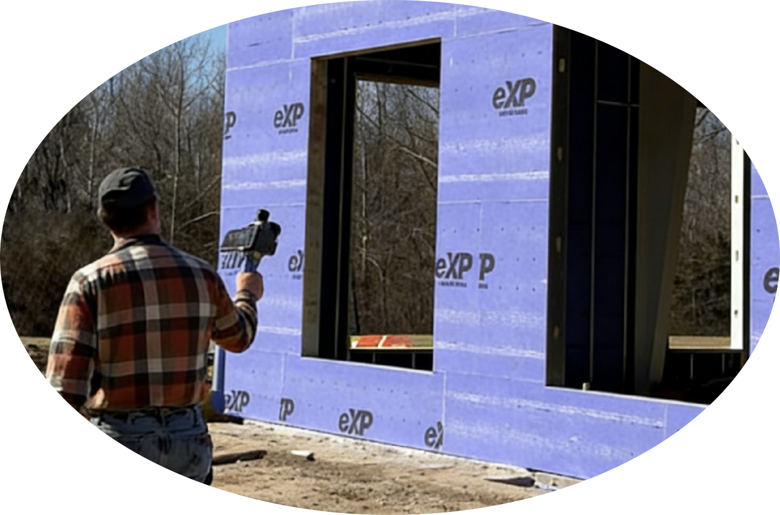
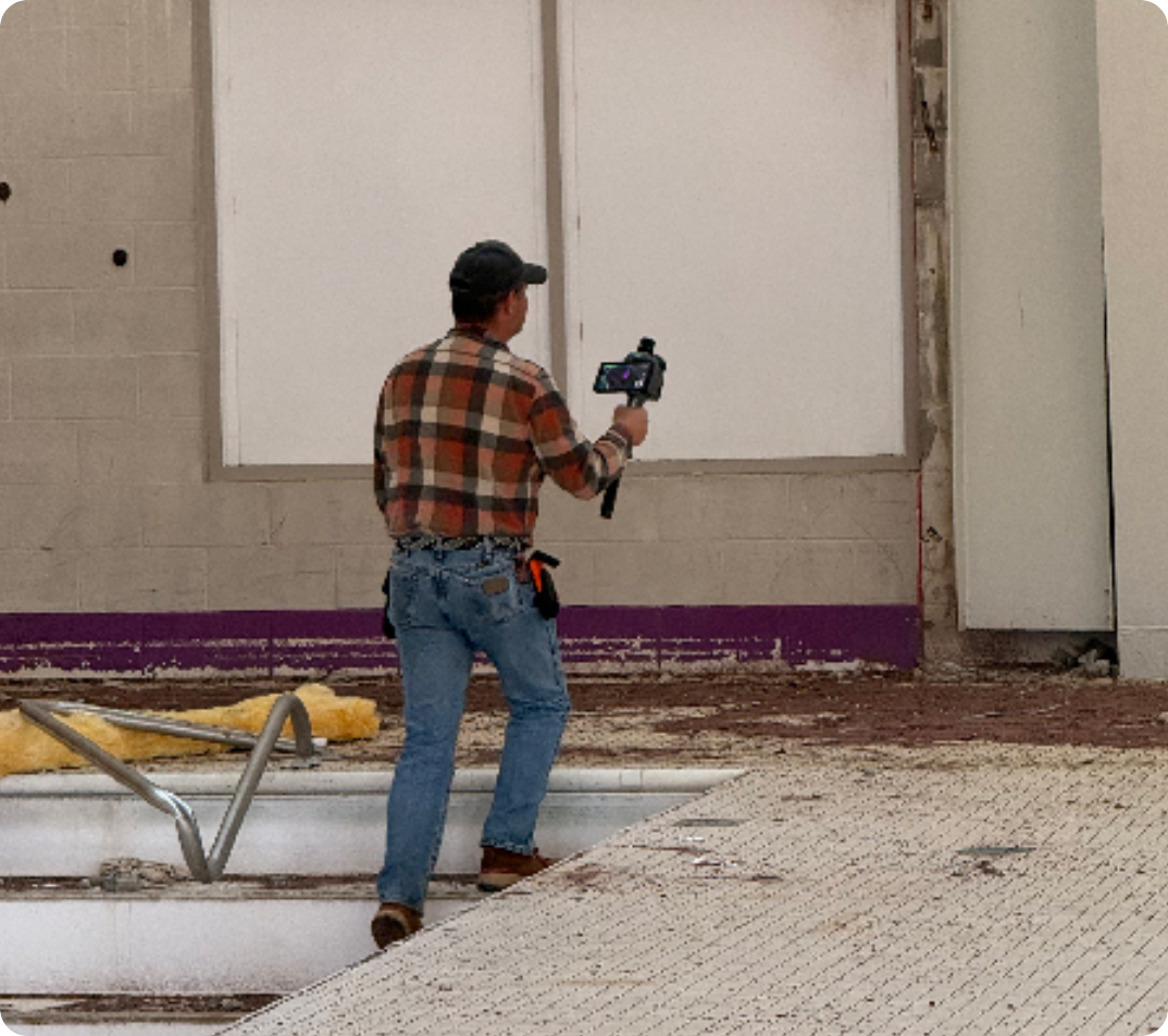
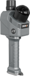
Small handheld design.
Full-constellation GNSS.
Georeferenced point cloud output.
The RS7 is available today, from stock, with
expert support from iGage!
[
Datasheet
] [
User Manual ]
The CHCNAV RS7 is a handheld real-time 3D LiDAR
SLAM scanner for collecting building interiors, enclosed facilities,
and exterior building features or outdoor scenes within a 20-to-30-meter
range.
Full-constellation
GNSS (GPS, GLONASS, BeiDou, Galileo) with 500-Hz, 0.5°/hour
IMU for georeferencing scans collected or started/ended outside.
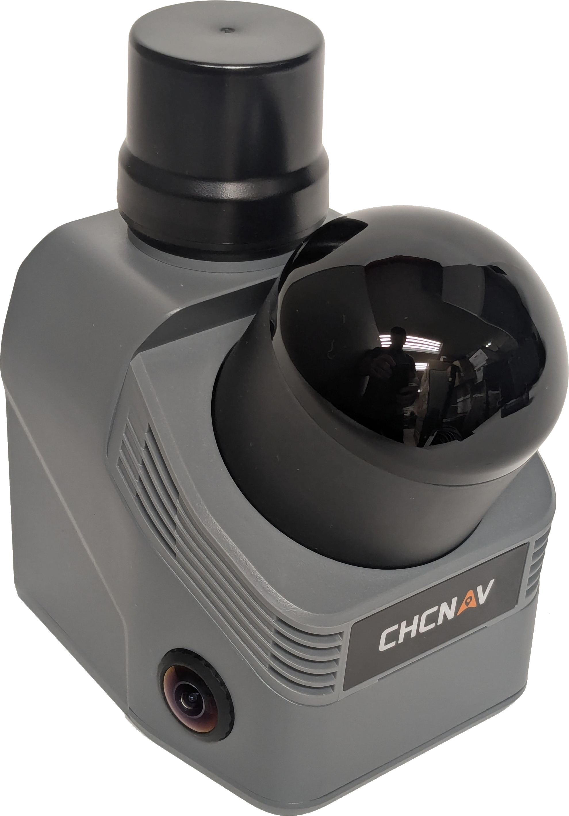
64-channel LiDAR at
1.15 million points/second with better than 1 cm relative and
3 cm RMS horizontal and vertical accuracy.
360° × 189° field
of view captures floors and ceilings simultaneously - one collection
completes the scan.
Dual 12 MP cameras
with Sony binning; colorized point clouds, 3D mesh, and 3D Gaussian
Splat outputs.
|
|
|
|
|
Bring-Your-Own-Android (BYOA)
Easily mount phone-size
Android devices to the RS7 with the included bracket.
SmartGo field software
(included) controls collection and allows point cloud preview to
confirm coverage before leaving the site.
CoPre desktop software
(included) delivers a georeferenced point cloud in any state plane
zone or local coordinate system.
512 GB internal storage,
IP64 rated. Lightweight 2.6-lbs. with a 150-minute battery integrated
in the handle - no external cables or batteries.
|
|
INS + SLAM Fusion Performance
|
|
The RS7 carries a 500-Hz IMU fused with
SLAM during collection. The inertial system maintains stable trajectory
through interiors, corridors, and enclosed spaces where GNSS sky
view is limited or absent. The result is 1 cm relative and 3 cm
absolute RMS accuracy.
The LiDAR scanning range is up to 40-meters
with a 20-30 meter ideal scan range.
The LiDAR's sensitivity allows the RS7 to
perform well in dark interiors where surfaces absorb light.
|
 |
|
GNSS-Grounded Positioning and Projected Coordinates
|
 |
CoPre handles GNSS trajectory processing,
coordinate transformation, and projection as native steps in the
standard post-processing workflow.
By connecting to a local base or CORS before
starting a scan, CoPre produces a georeferenced point cloud in a
state plane zone or custom project coordinate reference system.
For firms already using CHC, SG and iG GNSS
receivers, the coordinate system setup in CoPre will be familiar.
NATRF2022 is already supported, of course.
|
|
Physical Design and Durability
The 150-minute RS7 battery is integrated
directly into the handle, there is no external battery pack, no
charging cable over the operator's shoulder, and no connector to
snag on a door frame or cabinet edge.
The RS7 weighs 2.6 lbs with the battery
handle - less than many field tablets.
The RS7 has an IP64 rating protecting from
dust ingress and splashing water.
The 1/4-inch mounting thread is a standard
photographic thread, useful for attaching to monopods or handheld
mounts.
|
 |
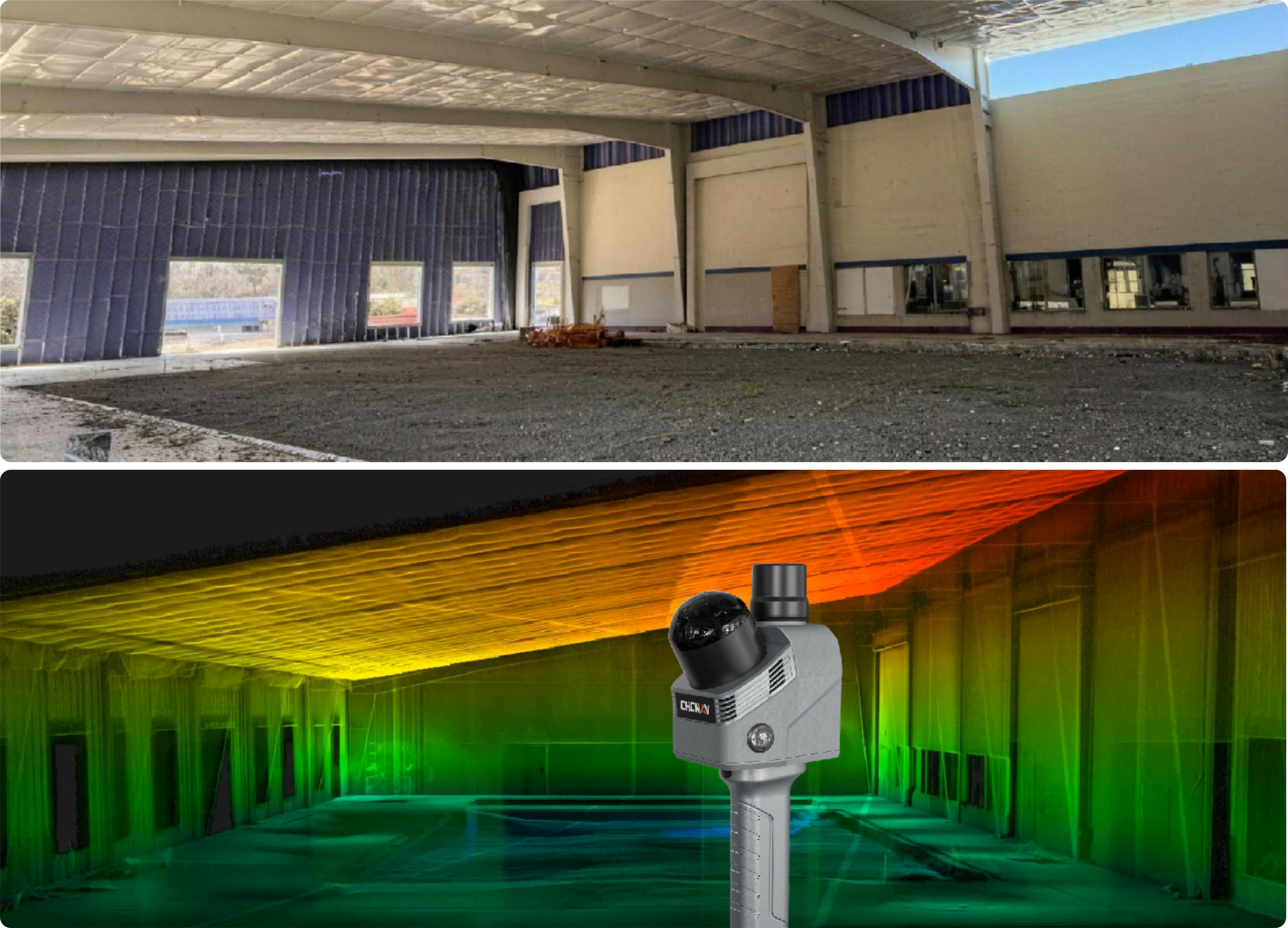
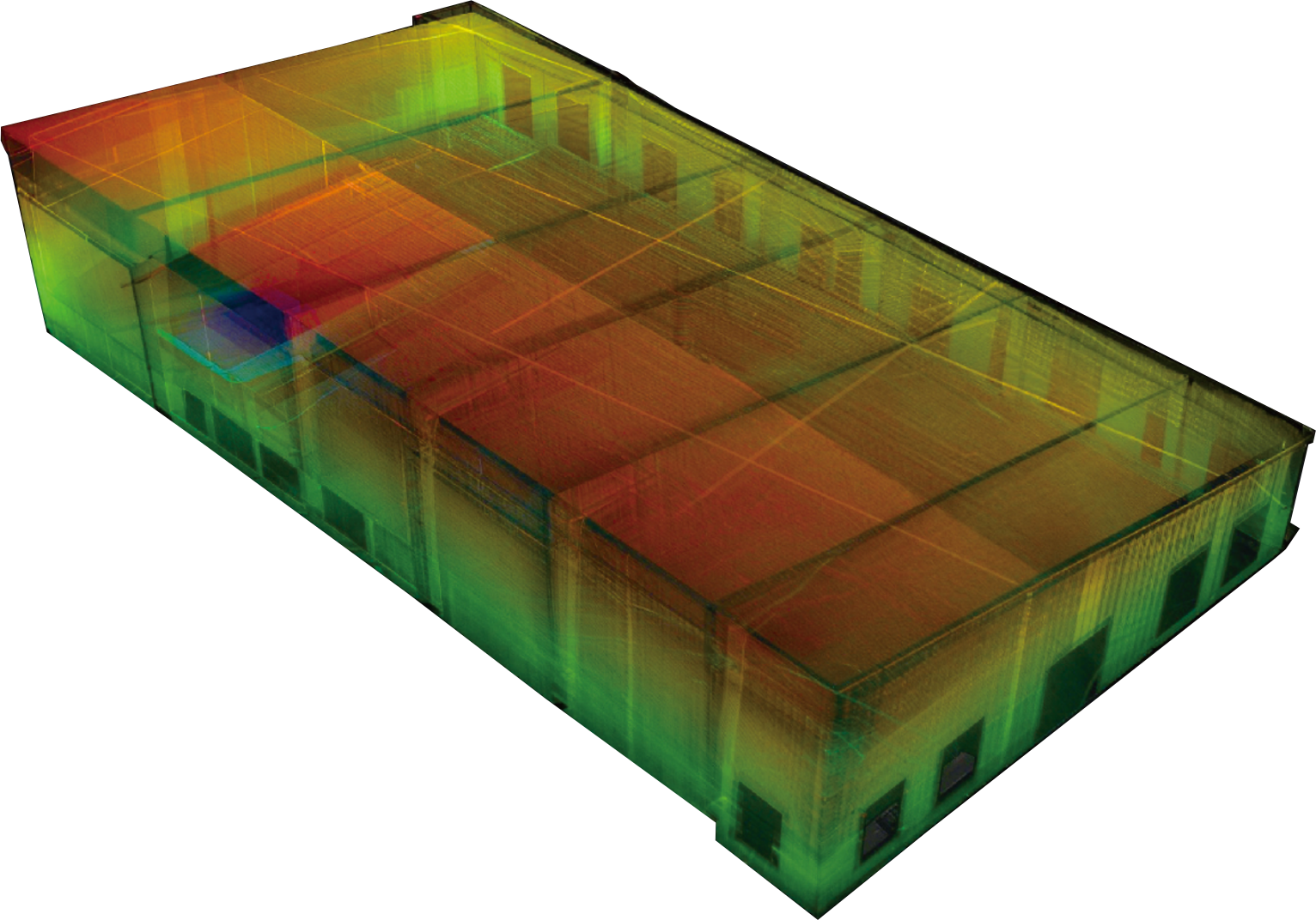
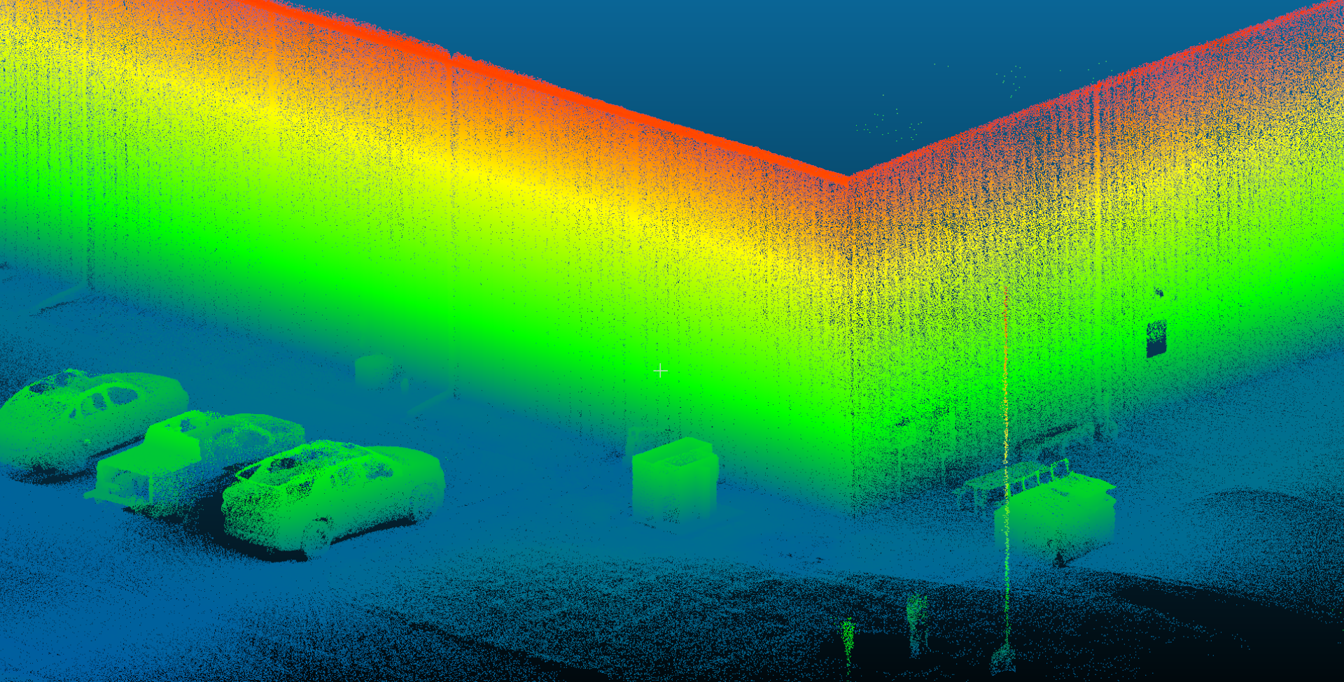
360° × 189° Field of View
|
|
The 189° vertical field of view captures the floor
below and ceiling above simultaneously from normal chest- or waist-height
walking posture. Walk the space once at a comfortable pace and the point
cloud is complete - ceilings, corners, confined alcoves, and all - with
no tilting and no second pass required. Combined with a dual-return scan
rate of 1,152,000 points per second, the RS7 captures fine surface texture
and small objects at this pace without sacrificing point density.
The full 360° horizontal coverage means there is
no preferred orientation to hold the unit and no need to sweep side to side.
Carry it naturally and it captures the full room.
|
HD Colorization and 3D Gaussian Splatting
|
|
The RS7 has dual 12 MP cameras with 1/2-inch sensors
and a combined field of view of 340°(H) × 360°(V), covering the a full horizontal
and vertical field of view.
Sensor binning technology combines pixels at capture,
delivering output under low-light conditions with substantially reduced
noise compared to raw 12 MP capture in dim interiors.
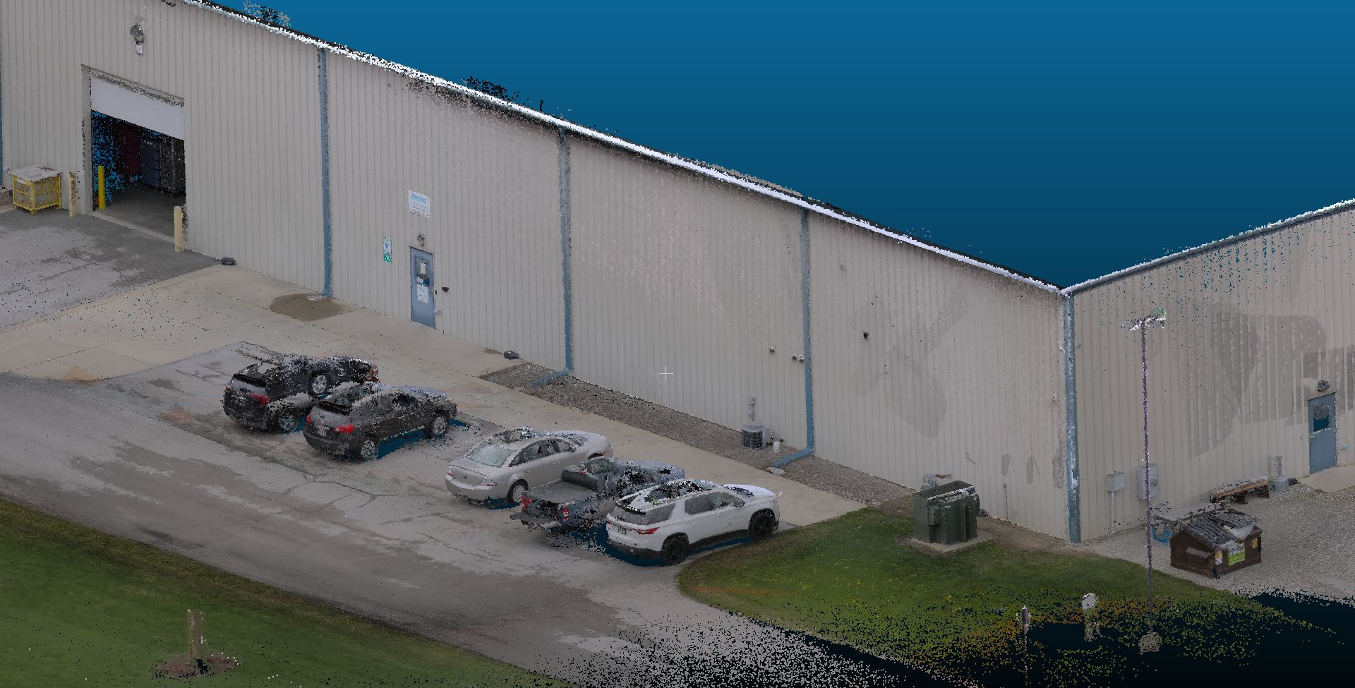
CHCNAV's HPGS 2.0 engine uses this imagery to generate
3D Gaussian Splat (3DGS) outputs (requires Flagship kit or annual subscription
see Pricing) alongside traditional colorized point
clouds and mesh models. 3DGS produces photorealistic, navigable scene reconstructions
that convey material finish, color variation, and spatial context in a way
a colored point cloud cannot.
For heritage documentation, insurance claims, forensic
evidence packages, or client presentations where the audience is non-technical,
the 3DGS output is a meaningfully different deliverable from a standard
point cloud.
|
Software: SmartGo, CoPre, CoProcess 2025, CoCloud
|
|
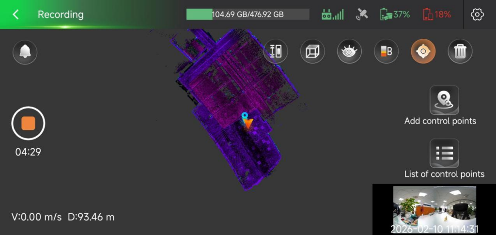
SmartGo runs on any Android and connects
to the RS7's onboard system during field operations. Scan control, real-time
point cloud preview, and data management. You can confirm coverage before
leaving the site rather than discovering gaps back at the office.
CoPre is the desktop post-processing platform
that provides full point clouds. It handles POS processing, trajectory adjustment,
point cloud generation, colorization, 3D mesh modeling, and 3DGS output.
CoPre is permanently licensed and is required to produce processed point
clouds or models from RS7 data. CoPre runs on Windows 11 and requires an
Nvidia graphics card for colorized cloud processing.
CoProcess allows data extraction from raw
point clouds. Filter point clouds to ground, draw linework, export .dxf
files. Set up layers and create deliverables from scan data in CoProcess.
CoCloud is an optional cloud processing subscription
for users without powerful PC hardware. Field data uploads; processing runs
automatically in the cloud and returns point clouds, mesh models, or 3DGS
outputs without requiring a high-powered workstation on-site. CoCloud and
CoPre desktop processing both produce the same output types. Teams planning
to use CoCloud as their primary processing path should confirm their upload
bandwidth before committing: large interior scan sessions generate large
files.
CoProcess 2025 adds built-in CAD tools for teams whose final deliverable
needs to be combined as line work into a CAD environment — floor plans extracted
from point clouds, as-built documentation, and BIM-ready geometry. If your
workflow ends at a colorized point cloud or mesh model, CoPre is sufficient.
If it ends at a CAD deliverable, CoProcess 2025 is the right addition.
|
Application Scenarios
- Architectural surveying and as-built documentation
- floor plans, section cuts, and BIM-ready geometry extracted from a
single walk-through scan; no targets, no setup time, no tripod
- Interior design and renovation - precise
existing conditions capture before design, with colorized point clouds
and mesh models for coordination across trades
- Public safety and forensic investigation
- rapid scene documentation in low-light conditions that captures every
surface, dimension, and spatial relationship in a repeatable, legally
defensible format
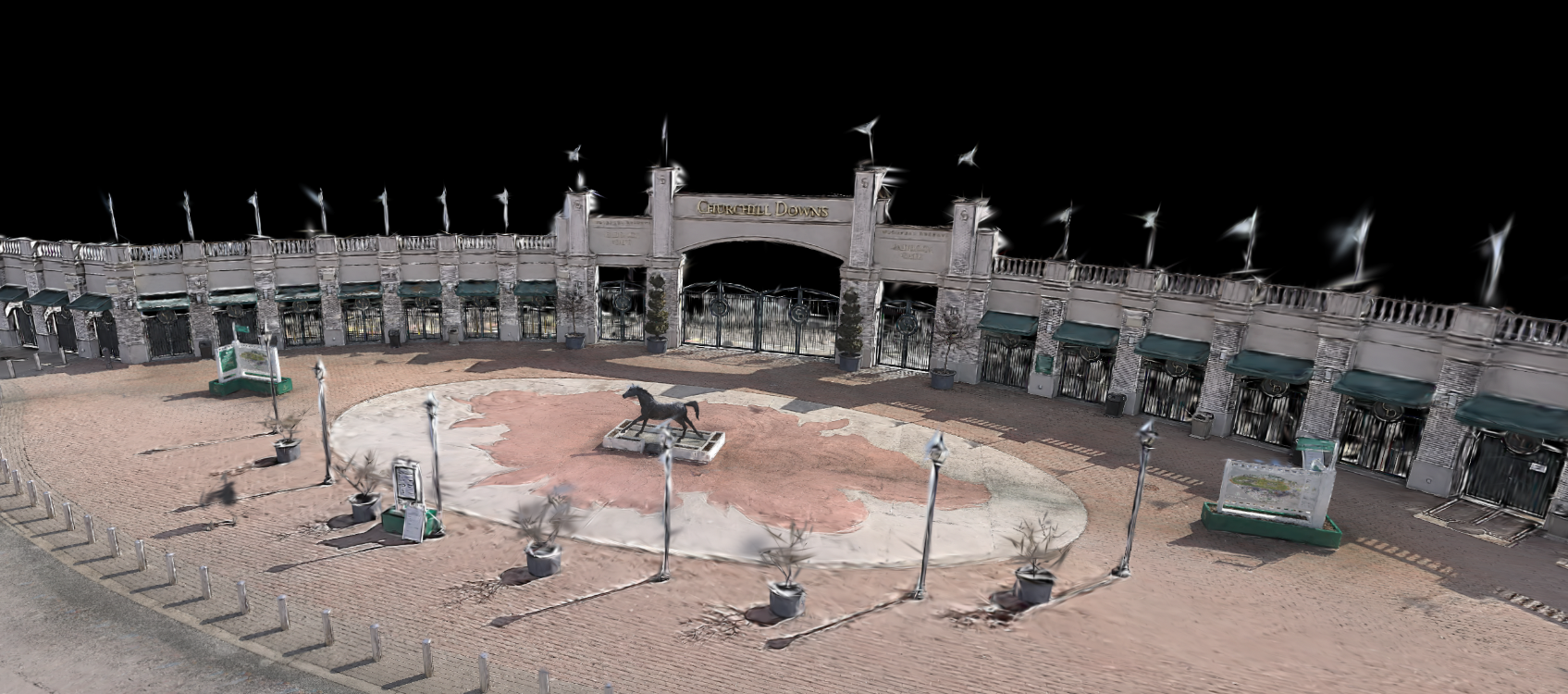
- Cultural tourism and heritage preservation
- high-resolution colorized point clouds and 3DGS outputs for documentation
archives, virtual tours, and conservation records
- Property mapping and calculation - interior
volumetric and spatial analysis for real estate, insurance, and facilities
management
Sample RS7 Dataset
Download and check out data!
Alta_Demo_RS7.LAZ
(2.2GB) collected by
iGage Mid-Atlantic
(Matt).
|
| |
Specifications
[
Datasheet ] [
User Manual ]
General System Performance
| Power supply |
Battery integrated in handle |
| Working time |
150 minutes |
| Data storage |
512 GB |
| Weight (with battery handle) |
1200 g (2.6 lbs) |
| Ingress protection |
IP64 (IEC 60529) |
| Mount |
1/4-inch mounting thread |
Laser Scanner
| Range |
40 m @ 10% reflectivity |
| Channels |
64 |
| Scan rate (single return) |
576,000 pts/sec |
| Scan rate (dual return) |
1,152,000 pts/sec |
| Field of view |
360° × 189° |
Camera System
| Number of cameras |
2 |
| Resolution |
12 MP per camera |
| Sensor size |
1/2 inch |
| Field of view |
340°(H) × 360°(V) |
Positioning and Orientation System
| GNSS |
GPS L1, L2, L5; GLONASS L1, L2; BeiDou
B1, B2, B3; Galileo E1, E5a, E5b |
| IMU update rate |
500 Hz |
| Gyro zero bias instability |
0.5°/hr |
| Gyro random walk |
0.01°/√hr |
| Acc zero bias instability |
10 µg |
| Acc random walk |
0.017 m/s/√hr |
|
Notes
RTK Corrections
For georeferenced scans, the RS7 needs a source
of RTK corrections or static base data. This applies to scans that begin
and end outdoors where a GNSS fix is possible.
The RS7 does not have a UHF radio. Corrections are
passed from the field tablet to the RS7 over a cellular connection.
If a high-quality survey-grade network is not available
but cellular data coverage exists, it is possible to use CHC or iGage base
stations which include free perpeptual APIS service. APIS allows
a single Base and one or more Rovers to connect through the internet cloud
with a SIM card in the base. It is very easy to configure.
If line-of-sight between the RS7 and base exists, Wi-Fi can be used for
correction backhaul.
If cellular service is not available, a local base
can record static data which is combined with the scan data in CoPre. The
SG7 and
eBASE are both good
choices for a local base because they support static. Wi-Fi and APIS/RTK
corrections:

|
BYO-Android
For controlling the RS7 during collection, the RS7 needs an Android device
running the SmartGo app. SmartGo is free to download and install on any
Android. You will want a phone-sized Android to clip in to the included
RS7 phone mount.
If you do not already have an Android device, consider pairing the RS7
with a low cost Android phone device such as
Tripltek Mini
or
Google Pixel 10a:

|
RS7 or RS10? Two Unique Scanning Tools
|
|
 or
or
The RS7 is purpose-built for building interiors,
tunnels, underground facilities, parking structures, enclosed spaces, and
building features. With no moving parts, lightweight design, and competitive
price the RS7 is a gateway to point cloud scanning and collection.
The RS10 is a larger
device with a spinning LiDAR with 120-meter range and 3x 5-megapixel cameras.
It features a survey-grade ground-plane antenna and the same GNSS engine
as our SG, iG, and CHC RTK receivers.
Call to discuss your application and use case.
|
Pricing
Kits include:
- RS7 Main Unit
- Battery
- Phone Holder
- Laser Head Lens Cleaning Cloth
- Power Adapter
- Data Cable
- Quick Start Guide
- CoPre(Perm) Software
- SmartGo scan management software (install on
unlimited Android devices)
See Notes for Bring-Your-Own-Android
collector information.
RS7 Kits
|
| |
|
RS7 |
CoPre |
3D Mesh |
CoProcess |
3D Gaussian
Splat |
CoCloud |
| License
Term |
|
|
Perm |
1yr |
1yr |
1yr |
1yr |
RS7
Standard
|
$ 10,999
|
ü |
ü |
û
|
û |
û |
û |
RS7
Geo
|
$ 12,998
|
ü |
ü |
ü |
ü |
û |
û |
RS7
Flagship
|
$ 14,999
|
ü |
ü |
ü |
ü |
ü |
ü |
|
Part #
|
|
1100100004 |
4109020543 |
4109020285 |
14007006V |
14007001C |
4109020306 |
RS7 Software & Device
Licensing
|
| Item |
Part # |
Term |
Price |
CoPre
|
4109020543 |
Perm |
$ 1,000
|
3D Mesh
Licensing
|
4109020285 |
1 year |
$ 1,500
|
CoProcess
|
14007006V |
1 year |
$ 1,000
|
3D Gaussian
Splat
|
14007001C |
1 year |
$ 2,000
|
CoCloud
|
4109020306 |
1 year |
$ 1,490
|
| SmartGo
field scan application is free to download and install |
|
What's in the case?
The RS7 kit is a complete system, just BYO-Android.
|
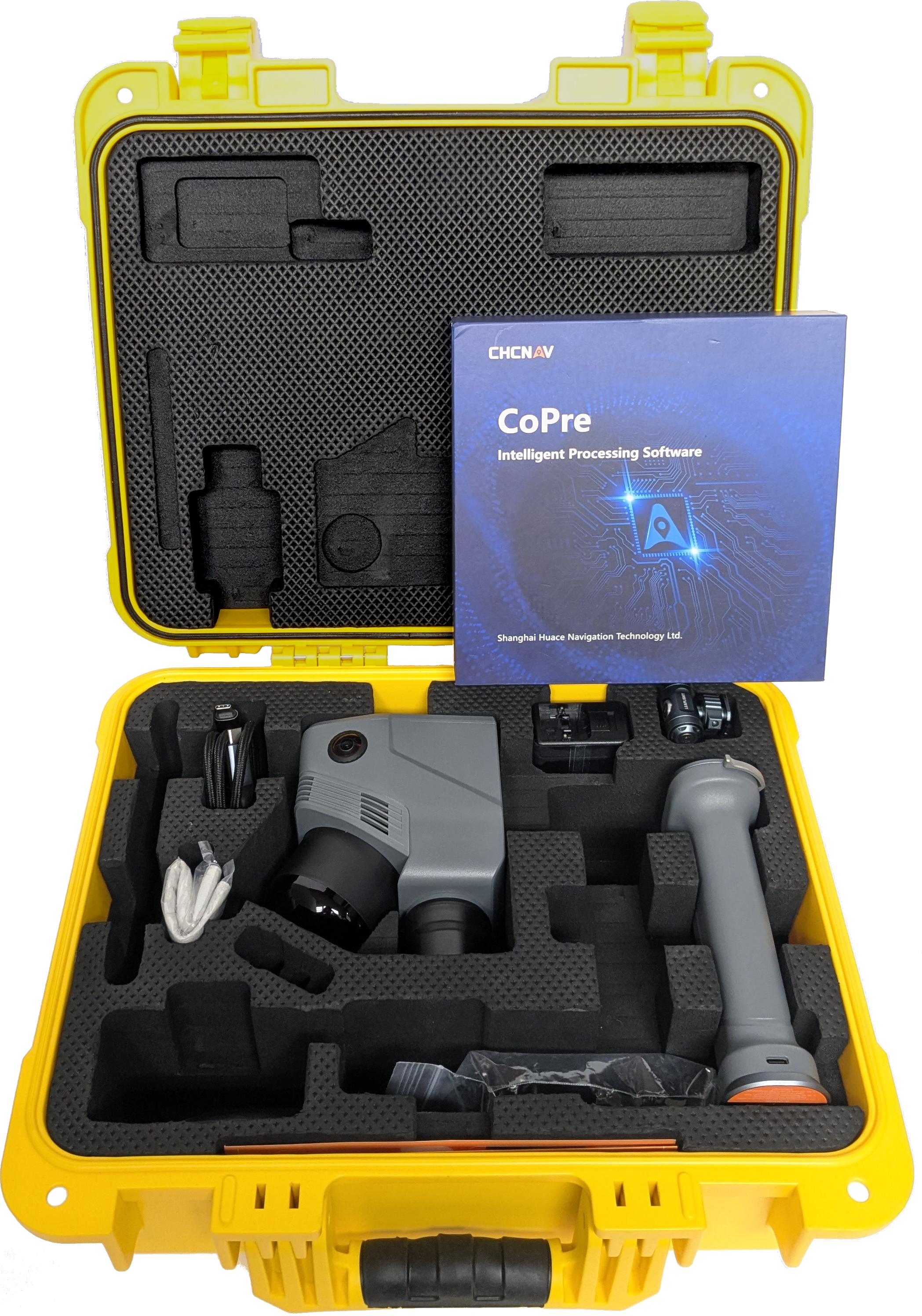
Carry Case Contains
|
|
RS7 body
|
|
Battery Handle
|
|
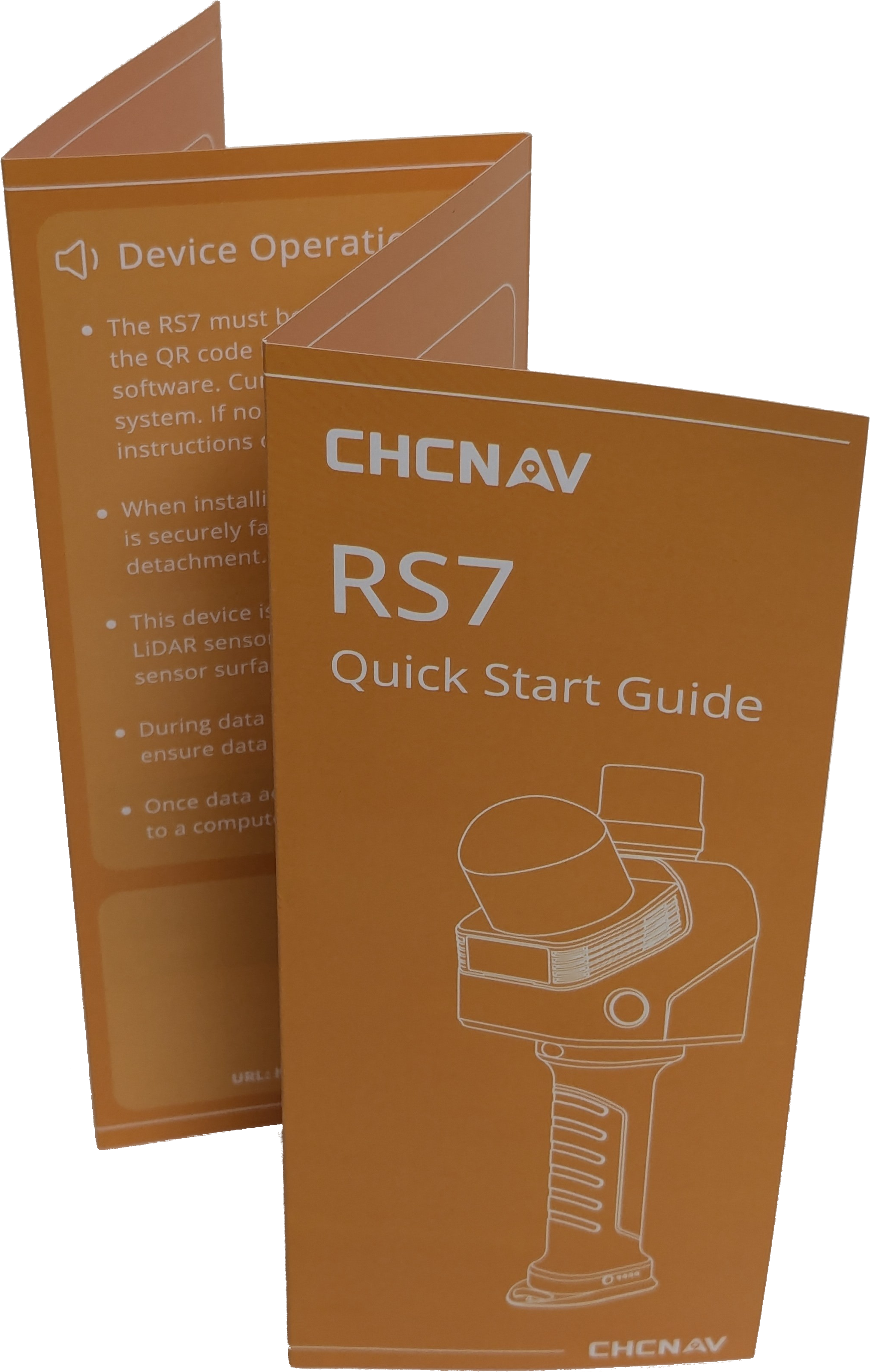
Quick Start Guide
|
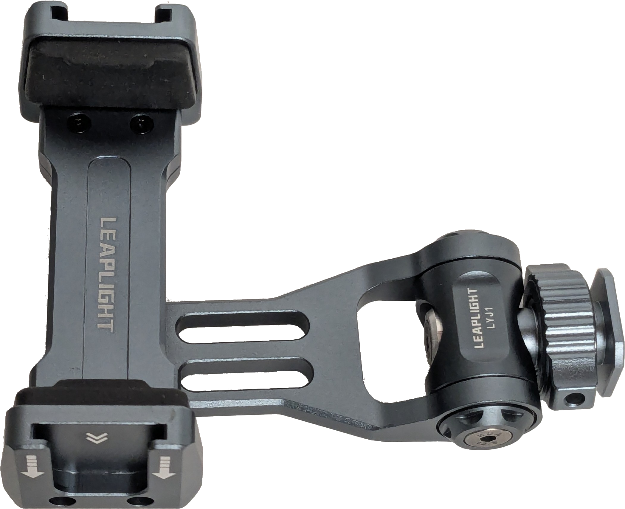
Phone Collector Mount (affixes to RS7)
|
|
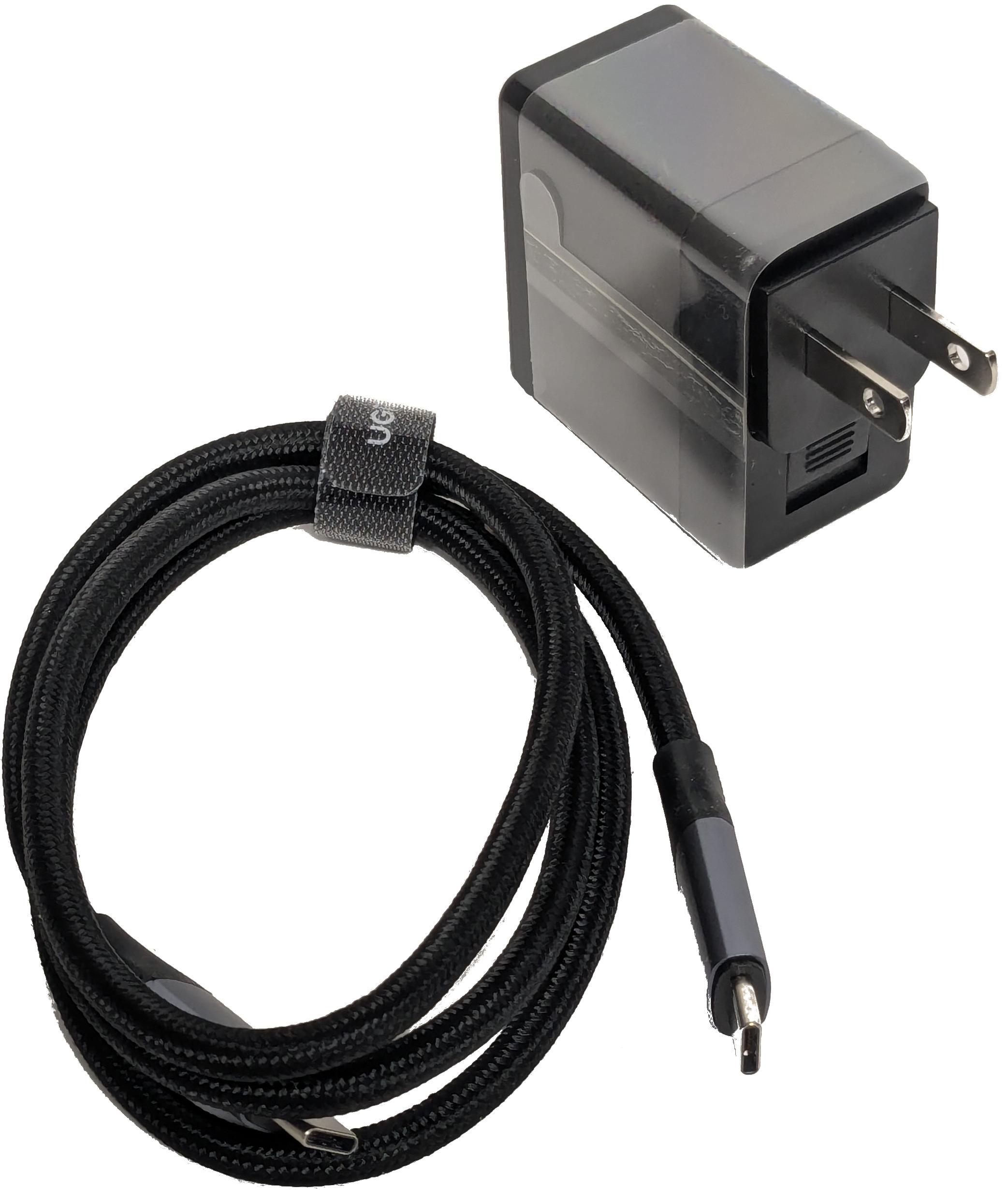
Data and Charging Cable
|
|
Microfiber Cloth
|
Hex Wrench |
|
Videos
YouTube videos from the manufacturer:
|
|